AT 309 Week 13 - Drone2Map Part 2: Processing Multispectral Data using GCPs for control
This week's lab covered processing data with ground control points, and making some maps using that data.
Ground Control Points (GCPs) are large photo-identifiable targets that are placed on the ground within the boundary of a mapping operation. They help add a much higher level of positional accuracy to the imagery.
One important note is that GCPs must be gathered in the same projection as your output data. They must be the same projection because if your output data is in a different projection than the GCPs, the data will be projected to the wrong place. The coordinate value of a GCP in one projection is not the same as a different projection. A latitude of 40 in two different projections will be in 2 completely different places.
We were asked to make 4 maps:
Shaded DSM with transparent DSM on top (figure 1)
Orthomosaic Map with Flight Lines, image locations, and GCPs (figure 2)
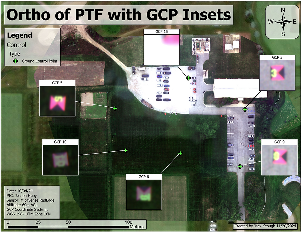
Orthomosaic Map with Detailed Insets of GCPs (figure 3)
Orthomosaic layout showing:
RGB (figure 5)
False Color IR (figure 6)
False Color Red Edge (figure 7)




Comments