AT 309 Week 4 - 3D Scan Missions
September 13, 2024
Purdue Turf Farm
Group Members: Benjamin Bradley, Kendrick Wittmer
The lab we were tasked to complete last week, consisting of various 2D and 3D scans with the Skydio and Mavic 2 Pro (through PIX4D) apparently was the wrong one, so we came back this week with some similar tasks. At least it served to give us some practice going into this one.
This weeks lab asked us to do a map capture scan of a large area at 200ft, a 3D capture of a simulated car crash, and a 2D capture (cross hatch and perimeter) of the area around our 3D capture. Due to the congestion of drone operations around that area, and the fact that people were getting approval to do scans of single cars, we chose to do the 3D scan of a red trailer in the back of the PTF gravel lot, as it kept us away from other crews and served as a good subject. Thus, the 2D capture was done in the area surrounding the red trailer. This lab was only for the process of flying and gathering the data. Processing the data will happen later. Mission reports and images can be found below.
Weather: 73 Degrees Fahrenheit, 5-10 mph wind speed, mostly overcast (occasional small breaks in clouds)
Site Conditions: operating over the parking lots and PTF building, moderate activity with other drone crews and PTF workers
Potential Hazards: Multiple other drone teams present, multiple PTF workers present.
Authorizations:
LAANC with an altitude ceiling @ 200 ft.
Missions:
Map capture @ 200ft AGL of red area (see photos)
3D capture of subject
2D capture of subject and surrounding area
Aircraft:
Skydio 2+ A - FA3HWRWHWK
Operation Timing:
Time to drive and set up: 30 min.
Map capture: 6 min
3D scan: 17 min
2D capture: 8 min
Mission Details:
Map Capture:
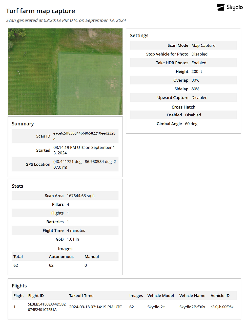
3D Capture:

2D Capture:

Photos:
Map Capture:

Figure 1. Map Capture mission area.
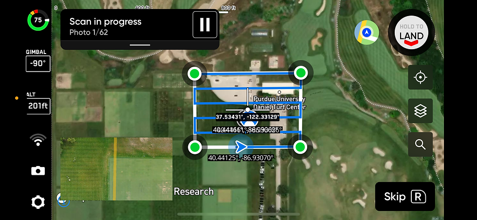
Figure 2. Screenshot of Skydio app mid-flight.
Figure 3. Sample gallery of map capture images.

Figure 4. Screenshot of map capture post-flight.
3D Scan:

Figure 5. Screenshot of Skydio 3D scan settings.
Figure 6. Sample gallery of 3D scan photos.

Figure 7. Screenshot of Skydio app during 3D scan.

Figure 8. Screenshot of skydio app post-flight.
2D Capture:
Figure 9. Sample Gallery of 2D capture.

Figure 10. Screenshot of Skydio render post-flight.


Comments