AT 309 Week 6 - ArcGIS Earth
This week we dove deeper into Remote Sensing concepts, platforms, and software, introducing ourselves to a cornerstone of GIS: ArcGIS. Specifically, ArcGIS Earth. ArcGIS Earth is a software used to display all kinds of data about geography, cartography, remote sensing, and every application you can think of. Some of the examples we looked at today included a terrain map of the earth, aerial imagery in various forms (natural, infrared), drone imagery, satellite imagery, and wildfire data. Additionally, ArcGIS Earth has many tools for UAS mission planning, as you are able to examine details of an area like elevation profile, viewshed, and line of sight. It also displayed the how different remote sensing platforms have their pros and cons. Satellites are great for scanning the whole earth. In the case of thermal hotspots, MODIS can detect anomalous thermal activity in a 1 mile radius. However, if you need to detect something with more accuracy than a mile, you may want to use a manned aircraft or UAS platform. I also saw how imagery from a UAS mission can be added on the map, allowing for detailed analysis of their information.
It is quite a powerful software, even if it's only one part of the ArcGIS family of products, and I can see it benefitting pre- and post-mission tasks greatly. Below I will show some pictures of what I did in ArcGIS Earth.
Images

Figure 1: Screenshot showing the ability to view terrain with varying elevation

Figure 2: Screenshot of elevation profile tool

Figure 3: Screnshot of viewshed tool

Figure 4: Screenshot of Line of Sight tool
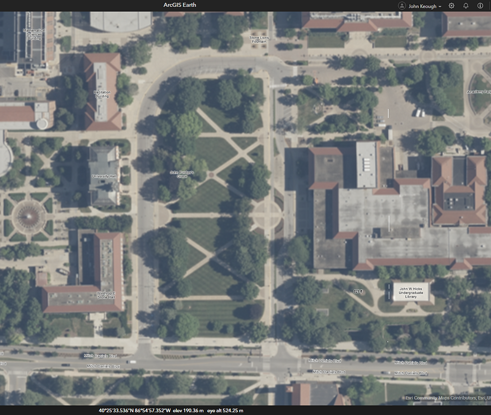
Figure 5: Image of Aerial Photos. You can even see the lawnmower patterns.
Figure 6: Comparison of Natural vs. NDVI images.
Figure 7: Comparison of Natural, NDVI, and Color IR images.
Figure 8: Photos displaying MODIS hotspots across North America
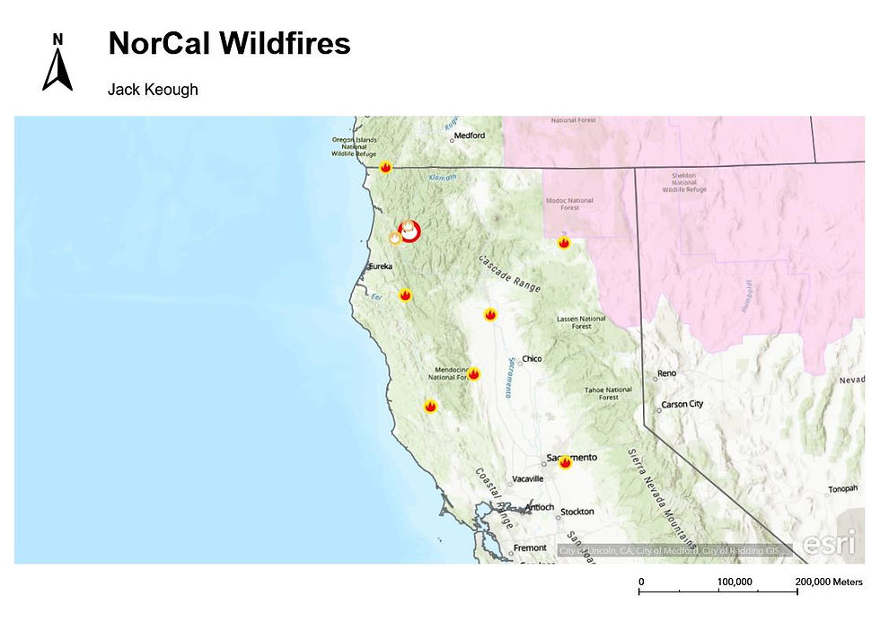
Figure 9: California Wildfire Map
Figure 10: RGB (Top) and Thermal IR (Bottom) Scans of Martell forest
Figure 11: RGB (Top) and Thermal IR (Bottom) Scans displayed next to outline of Martell Trail


Comments