AT 319 Week 4 - Topology and Advanced Editing
The main lab for week 4 has us following a outline document that covered concepts of topology, including using the topology wizard to create rulesets and examining errors that can occur when dealing with topology.
The first portion of this lab involved working with a premade dataset consisting of feature classes covering Besset in Southern France. First, I made a topology ruleset for the feature classes (Figure 1)

After applying this ruleset, I validated the topology and found that it resulted in a number of errors. Figure 2 shows visual examples of what causes these errors with regards to topology.

These errors are also listed in a table (Figure 3).

The table lists the specific errors and where they are, which can be visualized on the map outlined in red (Figure 4).

After this, I was tasked with creating a topologically correct map for three layers:
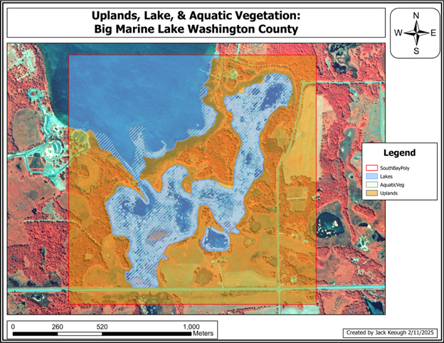
Uplands, Lake, and an Aquatic Vegetation layer. This consisted of digitizing all the elements described and creating a topology for it. The ruleset can be seen in Figure 5 and the final map can be seen in Figure 6.



Comments